The European constellation of atmospheric composition satellites
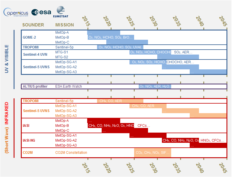
On behalf of the Earth Observation programme Copernicus of the European Commission, ESA and EUMETSAT are implementing a constellation of new-generation satellite sounders for the monitoring of atmospheric species relevant to air quality, climate forcing, the stratospheric ozone layer, and environmental hazards: O₃, NO₂, SO₂, HCHO, CHOCHO, CO2, CO, CH₄, clouds, aerosols…
These Copernicus missions (namely, the Sentinel-5p, -4, -5 and CO2M series) will be complemented by high-resolution profiling with ESA/BELSPO’s ALTIUS limb imager, and by thermal infrared capabilities with EUMETSAT’s IASI-NG (see Figure 1).
As part of the ground segment of this satellite constellation, BIRA-IASB develops validation environments and operational services dedicated to the necessary quality assessment of the satellite data, interoperability of the different sounders, and early warning of anomalies.
Fifth anniversary of TROPOMI operational validation service
Since its launch in 2017, Sentinel-5p TROPOspheric Monitoring Instrument (TROPOMI) pioneers the emerging constellation of atmospheric composition Sentinels.
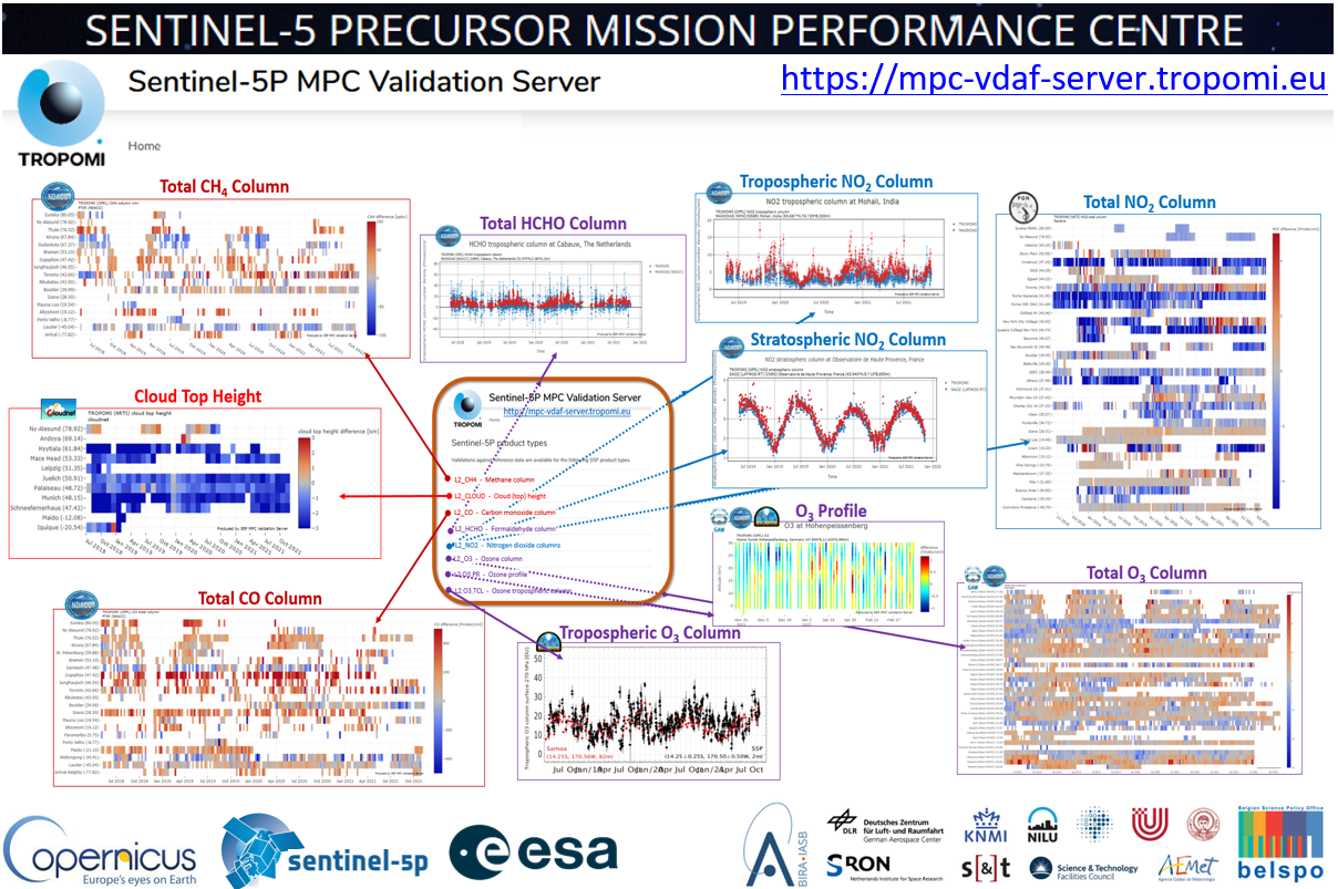
In the framework of the ESA/Copernicus Atmospheric Missions Performance Cluster, the Sentinel-5p Validation Data Analysis Facility (VDAF, see Figure 2) hosted at BIRA-IASB delivers operational services required to monitor routinely the quality and fitness-for-purpose of the TROPOMI data procured to the Copernicus services for Atmosphere Monitoring (CAMS) and Climate Change (C3S).
Building on a long-term heritage of ESA and EUMETSAT validation activities, the Sentinel-5p VDAF contributes significant advances in terms of operationality, standardisation, and capabilities.
Copernicus Cal/Val Solution
In 2020-2022, BIRA-IASB coordinated the atmospheric theme of the EU-sponsored consultancy Copernicus Cal/Val Solution (CCVS) set up to define a holistic solution for the calibration and validation of all Copernicus Sentinel missions.
Shortcomings in current validation activities were identified regarding the availability of validation requirements, validation standards, fiducial reference measurements, data distribution services, and the calculation of uncertainties. A roadmap was proposed to implement a sustainable solution in a staggered approach.
Several of the CCVS recommendations are now being addressed in studies dedicated to the preparation for the upcoming CO2M and Sentinel-4 and -5 missions, and for the ALTIUS limb profiler.